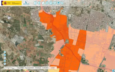
Flood Risk Assessment Map for Spain
Flood Risk Assessment Map for Spain
If you're considering buying property in Spain, it's crucial to understand the potential flood risks in different areas.
This embedded flood risk map viewer from the Spanish Ministry for Ecological Transition and Demographic Challenge (MITECO) is an invaluable tool for English-speaking expats and property buyers.

How to use the Spain flood risk map
- Click the map icon
- Enter your town or address under the 'direcciones y referencias catastrales' box
- Click the map pin icon
- Once the map moves to your location, close that box
- Once you've located your area on the map, look for the "Arbol de servicios" (Services Tree) panel on the left side of the screen. This is where you can access various map layers and data related to flood risks.
- Under the "Arbol de servicios" panel, you'll see different options like "Mapas de peligrosidad" (Hazard Maps), "Mapas de riesgo" (Risk Maps), and "Riesgo a las actividades económicas" (Risk to Economic Activities).
- Clicking on the "+" icon next to each option will expand the menu and allow you to view the corresponding map layers. For example, the "Riesgo a las actividades económicas" option will show the risk to economic activities in your area.
- Familiarize yourself with the different map layers and the color-coding used to indicate low, medium, and high-risk areas. This information can help you assess the potential flood risks for properties you're considering.
- Additionally, the map provides access to other relevant information, such as "Dominio Público Marítimo Terrestre" (Public Maritime-Terrestrial Domain), "Inventario de Presas y Embalses" (Inventory of Dams and Reservoirs), and "Redes de medida de caudales en ríos" (River Flow Measurement Networks).
- By exploring these various map layers and data sources, you can gain a comprehensive understanding of the flood risks in the areas you're interested in, which can inform your property purchasing decisions.
Remember, this tool is provided by the Spanish government to help citizens and property buyers make informed decisions. If you have any specific questions or concerns, it's always recommended to consult with local authorities or real estate professionals for further guidance.
Understanding Flood Risks in Spain
Spain faces significant flood risks, with over 1 million homes located in hazardous areas. This accounts for approximately 4.3% of all dwellings in the country. Regions along the Mediterranean coast are particularly vulnerable, with the Region of Murcia having the highest percentage (17%) of homes affected by flood risk.
Key Areas of Concern
Several major cities in Spain have a substantial number of homes in flood-prone areas:
- Murcia: 60,775 homes (28.6% of total)
- Valladolid
- Palma
- Girona
- Cartagena
Some smaller towns, like La Algaba (Seville), Deltebre (Tarragona), and Santoña (Cantabria), have over 70% of their streets in flood risk zones.
Using the Flood Risk Map Viewer
The embedded viewer allows you to:
- Zoom in on specific areas of interest
- View different flood risk levels (e.g., 10-year, 100-year, 500-year return periods)
- Identify flood-prone zones near potential properties
Importance of Flood Risk Assessment
Understanding flood risks is crucial when moving to Spain because:
- It affects property values and insurance costs
- It helps in making informed decisions about where to live
- It prepares you for potential emergency situations
Recent events highlight the importance of this information. In October 2024, severe flooding in Valencia resulted in over 200 fatalities and significant infrastructure damage across multiple regions.
Flood Risk Management in Spain
Spain has been implementing the European Directive 2007/60 on flood risk assessment and management. This includes:
- Identifying areas with potentially significant flood risk
- Developing flood hazard maps
- Creating flood risk management plans
These efforts aim to improve awareness and preparedness for flood events throughout the country.
Historical Flood Events in Spain
Spain has a long history of significant flooding events that demonstrate the importance of flood risk awareness:
- 1957 Valencia Flood: A catastrophic event known as “La Gran Riada” that led to major changes in flood control infrastructure
- 1962 Vallés Floods: Severe flooding in Catalonia that affected multiple municipalities
- 1983 Spanish Floods: Widespread flooding that impacted various regions across the country
- 2002 Tenerife Flood: Significant flooding on the Canary Islands
- 2020 Storm Gloria: Caused extensive flooding along the Mediterranean coast
- 2024 Valencia Floods: Tragic flooding in October 2024 that resulted in over 200 fatalities and significant infrastructure damage
These historical events have shaped Spain’s approach to flood risk management and led to improved prevention measures and warning systems.
By using our embedded flood risk map viewer, you can make more informed decisions about where to live in Spain. Remember that while some areas may have higher flood risks, proper planning and awareness can help mitigate potential dangers. Always consult local authorities and real estate professionals for the most up-to-date information on specific properties and locations.
Flood Risk Management in Spain: Comprehensive Land-Use Guidelines
This official document from the Spanish Ministry for Ecological Transition and Demographic Challenge [PDF Download] provides crucial technical details about Spain’s comprehensive flood risk management strategy. It offers an in-depth explanation of the legal framework, land-use restrictions, and zoning regulations in flood-prone areas.
Understanding Flood Zones in Spain
Spain has implemented a sophisticated system for managing flood risks through carefully defined river areas:
- Hydraulic Public Domain: Includes land covered by water during maximum normal rise levels
- Easement Use Area: A 5-meter strip on both sides of the riverbed to protect ecosystems
- Police Area: A 100-meter wide strip with strict usage regulations
- Preferential Floodway: High-hazard area with concentrated flood flow
- Flood-Prone Area: Zones covered by 500-year flood events
Key Flood Risk Management Objectives
The Spanish government’s flood risk management strategy focuses on:
- Improving land use and urban planning policies
- Establishing compatible activities in flood-prone areas
- Implementing strict land-use limitations
- Protecting human life and infrastructure
- Ensuring transparent risk communication